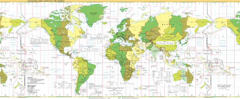
Tonight I’m going back to Samoa to pick up my Chinese visa. It will be my fourth trip across the date line in a month. I’ll have to make a 5th trip across in a few days going back to Fiji. I might have to make a 6th and a 7th crossing, but I’ll know more about that shortly. I hope I don’t have to.
Everyone is pretty familiar with time zones. I’m sure you’ve crossed time zones and have an intutitive understanding why they exist. The Earth is a sphere and we have noon at different times. The idea originally came from the railroad companies. Because each town would have a different noon (the time at which the sun is at its highest point) organizing schedules became difficult. Time zones were a means to keep everyone on the same page for what time it was.
In theory its pretty simple. Greenwich, English was picked as the arbitrary point for the Prime Meridian. There is nothing special about it, its just that is where the Royal Observatory happens to be and the English in the 19th Century took the lead in these matters.
Because there are 24 hours in a day, the Earth should have 24 time zones of one hour increments, going 12 hours plus or minus from Greenwich. Exactly on the other end of the Earth, there needs to be a line where the day changes, else it gets into problem when each side going backwards and forwards meet each other on the other side.
Picking Greenwich as the Prime Meridian was actually a good move if only because it put the 180 degree longitude line in the middle of nowhere in the Pacific Ocean. 180 degrees longitude is the theoretical date line.
In practice, however, you have to move it a round a bit. Most countries don’t want to have their countries split in different parts by day. It makes things really confusing. There is a tiny stub of Siberia which is in the western hemisphere, a few of the last islands in the Aleutian Island chain in Alaska are in the Eastern Hemisphere, some of the minor island in Fiji are in the west….and the nation of Kiribati (which I’ll get to soon).
What I said about there being 24 time zones is also not true in practice. There are some time zones that are offset by a half hour (Labrador and Newfoundland for example. There are also some odd fractional hour time zones in India. China puts the whole country into one time zone, even though it should really be five.
And then there is Tonga. Even if there aren’t 24 time zones, you’d think they still would all be within 12 hours plus or minus of UTC (UTC = Greenwich Mean Time without daylight savings). You’d be wrong. Tonga is +13 UTC. It is east of 180 degrees longitude, but sits on the west side of the date line.
Kiribati is the worst offender. It is a country of several island chains in the north Pacific. The country is really spread in two on either side of 180 degrees longitude. They just lumped everything together and made a huge bend in the dateline. They only only have parts which are +13 UTC, they also have islands that are +14 UTC. The same clock time as Hawaii, but a day ahead!
I think Tonga is on this side of the date line so they can share the same day as New Zealand and Australia who are their major trading partners. Kiribati I think did it so it could say it was the first country in the world to usher in the year 2000. (Geraldo went there, so it must have worked to some degree)
My 6th and 7th crossing will all depend on if they still run flights from Kiribati to the Marshall Islands. If they do (and all the flight schedules you see online are usually out of date) then I don’t have to. If they don’t, then I may have to fly to Hawai’i, which I’d rather not have to do. Ideally, I’d like to fly Our Air (formerly Air Nauru) from Honoria to Nauru to Tarawa, Kiribati then to the Marshalls. That would be the easiest trip, but I have read they may cancel the Tarawa and Marshalls part of the flight.
Such is life in the Pacific…..